Hiking tours in the Narsarsuaq area
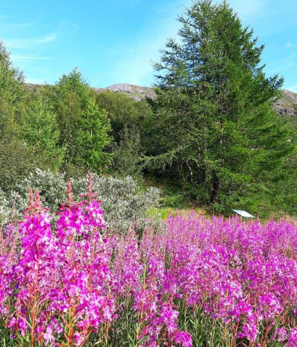
Besides being the starting point for most people’s stay in South Greenland, Narsarsuaq offers several very nice walks. In contrast to nearby areas, there are no sheep in Narsarsuaq. This gives the area a different type of vegetation than you would otherwise encounter. There are a considerable number of flowers compared to where the sheep graze, and shrubs and trees can grow to a height of several metres in Narsarsuaq!
The following descriptions include half-day tours, day trips and tours with accommodation (tent). The colours of the routes refer exclusively to the overview map and have nothing to do with any trail marks on site, nor do they indicate any particular level of difficulty.
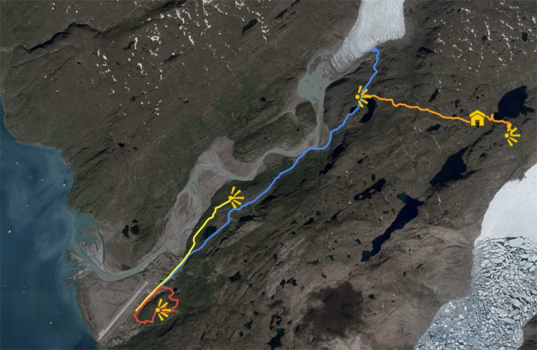
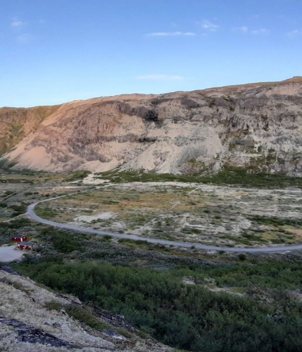
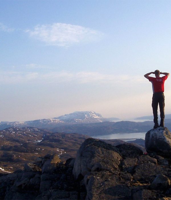
Signal Hill (226 m) (round trip). Red route
Distance: About 4 km. 1-1½ hour. Max elevation 226 m.
Map: Arctic Sun. Narsarsuaq (Qassiarsuk – Igaliku) 1:50,000
Orientation/difficulty: Marked. Easy hiking. Gravel road and path.
Accommodation: Narsarsuaq Hostel or Hotel Narsarsuaq.
The hike to the top of Signal Hill is a “must” if you stay in Narsarsuaq. It is a short and easy walk of ap-proximately 1 hour, where you are rewarded with a great view of the ice sheet and excellent views of the Narsarsuaq area.
Route description
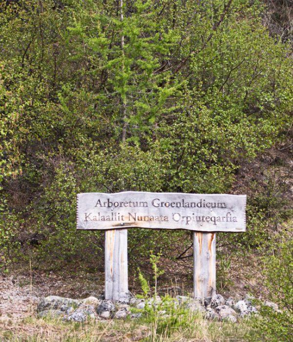
Start the tour at the Narsarsuaq Arboretum (behind the hotel) where a sign points to Signal Hill. The path winds, sometimes steeply, between willow bushes and planted trees in the arboretum. Follow the red marks and you will be led into a ravine between the two “peaks” of Signal Hill. Head to the higher peak to the right, and from here a gravel road leads down again. On the way down (at the old concrete building), you can follow the marked path down past the hostel, or take the gravel road all the way down to behind the store. The gravel road can also be used as an alternative route up. It is a little longer but not as steep as the trail.
The Ridge (174 m) (return). Yellow route
Distance: About 8 km. 3-4 hours. Max elevation 174 m.
Map: Arctic Sun. Narsarsuaq (Qassiarsuk – Igaliku) 1:50,000
Orientation/difficulty: Marked. Easy hiking. Gravel road and path.
Accommodation: Narsarsuaq Hostel or Hotel Narsarsuaq.
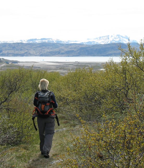
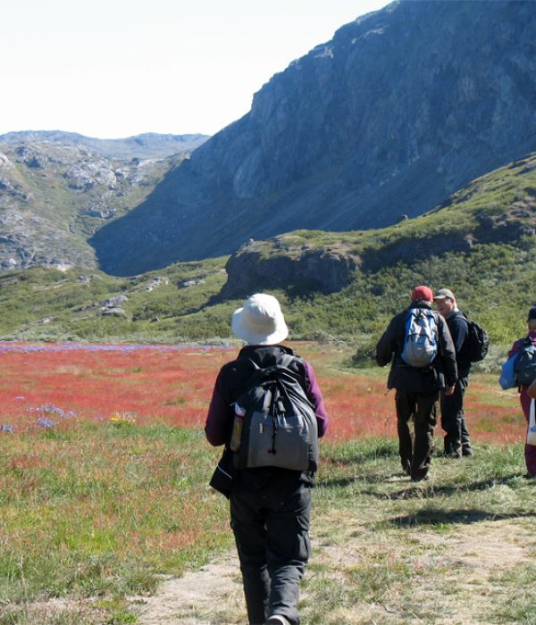
The Ridge is a very nice, shorter and easier alternative to the full-day tour to Narsarsuaq Glacier. If you are you unsure that you can handle the climb to the glacier (see its description), we recommend the hike on the ridge, rather than a trip through the Flower Valley. The Ridge offers great views, a rich flora and fauna (birds, mountain hare) and is also an excellent trip in bad weather (e.g., strong foehn winds)!
Route description
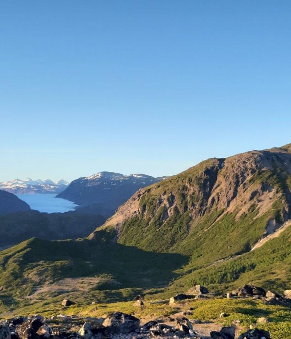
Follow the asphalt road towards the Hospital Valley and Flower Valley. Once you have passed the last concrete building on your left, turn left by the gravel road (sign for “The Ridge”) and follow this uphill. This takes you along a protected path between bushes and trees and with a myriad of flowers (actually more than in the Flower Valley!). You have views down to the Hospital Valley and Flower Valley on one side and the large meltwater river, on the other side. After crossing an old bridge, you continue on the marked path all the way to the highest point (there is only one single steep section). From point 174 you are rewarded with a fine view of the glacier. It is not recommended that you try to descend directly to the Flower Valley from the ridge. It is best to take the same way back.
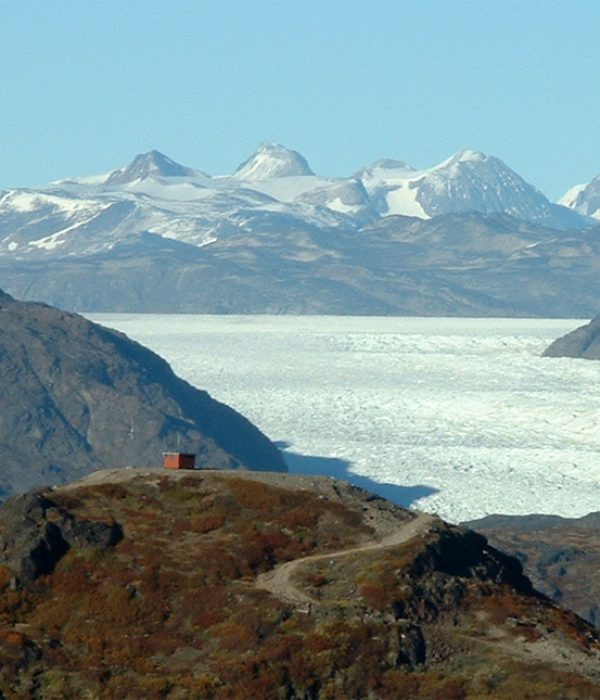
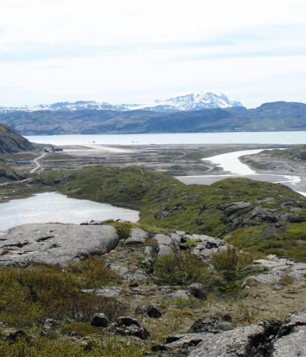
Narsarsuaq Glacier (return). Blue route
Distance: About 16 km. 5-7 hours. Max elevation 304 m.
Map: Arctic Sun. Narsarsuaq (Qassiarsuk – Igaliku) 1:50,000
Orientation/difficulty: Marked. Easy to moderate hiking. Path and easy terrain, but steep ascent and descent.
Accommodation: Narsarsuaq Hostel or Hotel Narsarsuaq.
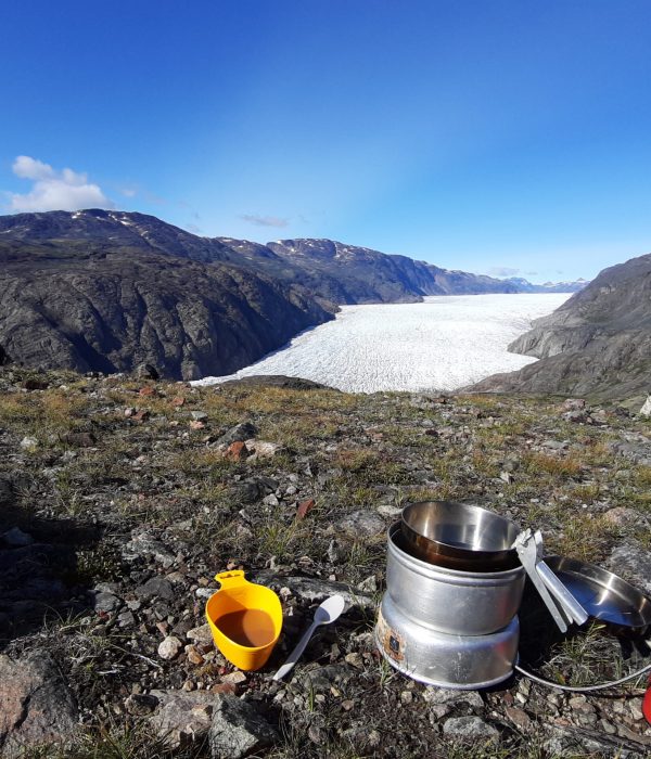
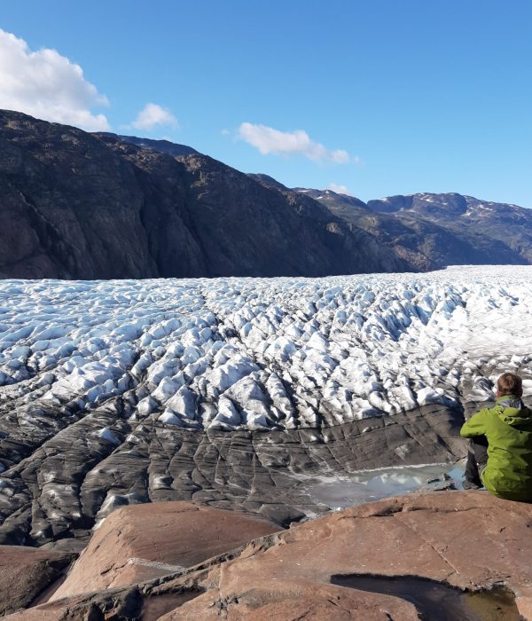
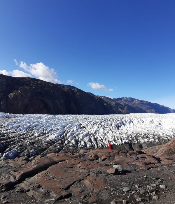
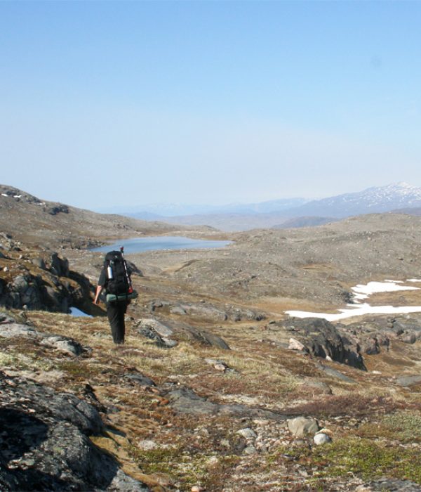
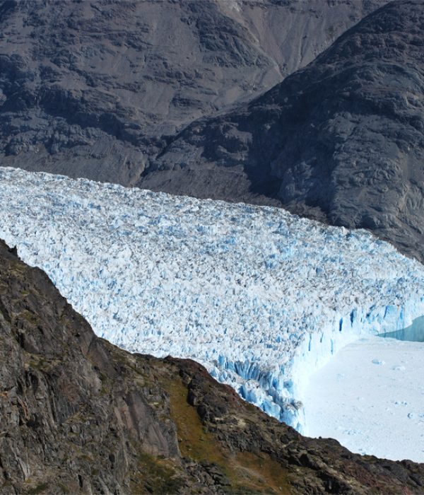
The hike to the ice cap (Narsarsuaq Glacier) is a classic walk from Narsarsuaq. In a day trip you can reach the glacier and touch the ice! Furthermore, it is a nice trip that passes through several different types of landscapes. You can buy transport for the first 3 km of paved road, or rent a bicycle for a day for this stretch.
Route description
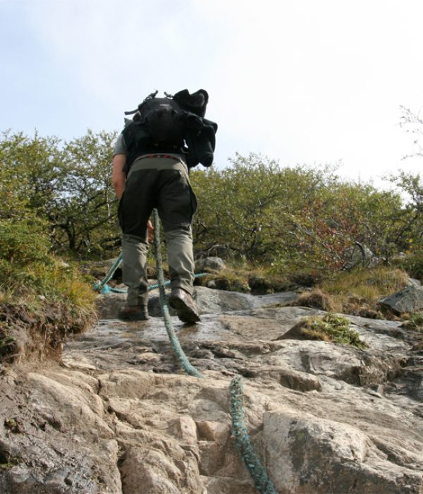
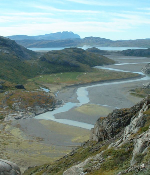
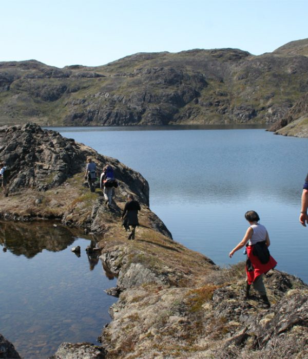
Follow the asphalt road to where it ends in the Hospital Valley and continue on the gravel road through the pass from where you look down into the Flower Valley. In the Flower Valley you follow the gravel road (which becomes a path) on the right side of the valley. When you reach the foot of the waterfall in the innermost right-hand corner of the valley, you can see the trail climbing steeply to the left of the waterfall. The ascent is about 300 metres. On the steepest parts ropes have been fixed for support for the ascent/descent. You do not need to be a climber, but you should feel steady on your feet! When you arrive at the plateau, follow the marks and cairns right around the first lake and then straight ahead about 1 km. From here there are stunning views of the glacier. From this vantage point it is 30-45 minutes down to the edge of the ice and 1-1 ½ hours back (about 250 metres difference in elevation). If you are very cautious, it is possible to step on the ice! Be aware, though, that the glacier edge can be unstable and you should not move farther up onto the glacier without equipment. Take the same way back.
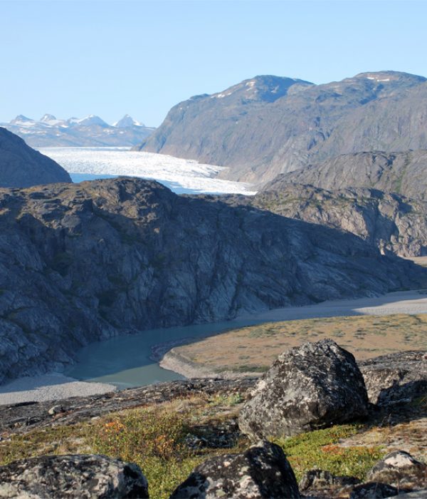
Narsarsuaq – Qooroq view (Mellemlandet). Orange route
Distance: About 14 km from Narsarsuaq to the view point (one way). About 5 hours. Max elevation 591 m.
Map: Arctic Sun. Narsarsuaq (Qassiarsuk – Igaliku) 1:50,000
Orientation/difficulty: The first part is marked. When leaving the trail to Narsarsuaq Glacier, there are only sparse cairns and marks. Moderate to rough terrain.
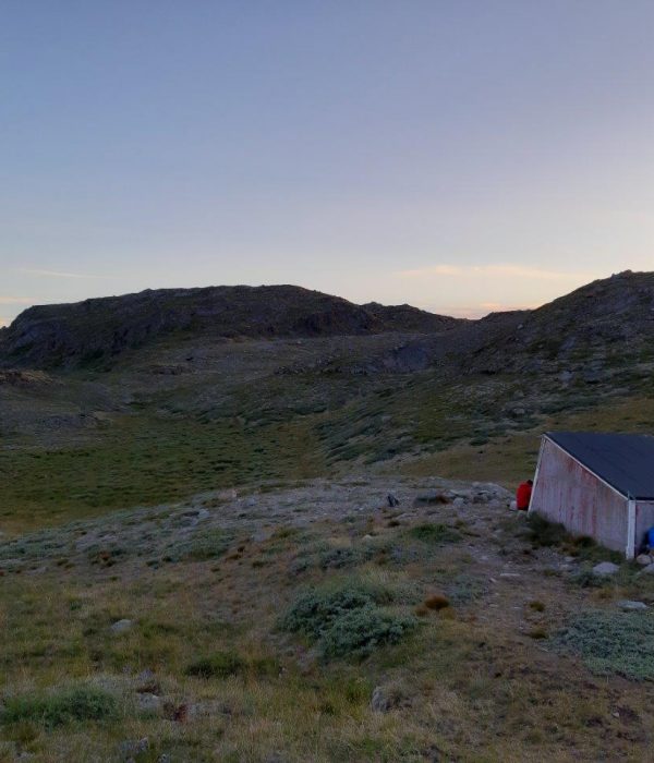
GPS coordinates: The shelter is located at 61.205627, -45.252898
Accommodation: The trip can be done as a long day trip from Narsarsuaq (10-11 hours return). You can also bring a tent and take a multi-day hike in “Mellemlandet”.
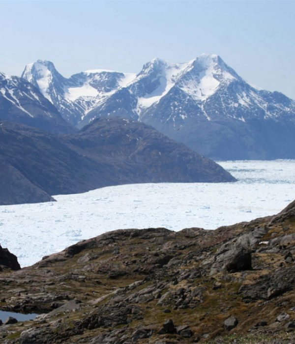
The Qooroq viewpoint is merely a spot in “Mellemlandet” (as the mountainous area between the two glaciers is called) where you have a fabulous view over the Qooroq Glacier and the ice fjord. However, it is probably the most accessible point, and can actually be reached in a long day trip from Narsarsuaq. In addition, there are endless possibilities for multi-day trips throughout Mellemlandet if you bring a tent. The terrain is not difficult, but includes many small hillocks and low scrub vegetation, and you must be able to orientate with a map and compass.
Route description
The walk to the Qooroq viewpoint follows the first part of the route to the glacier (see this). On the plateau after the ascent, and after you have passed the last lake, turn eastward, walking uphill and aiming at the lowest point. You maintain roughly the same course all the way up. There is a small emergency shelter situated just before Lake 475 (on the map). Once you reach the lake, head to its southern end, cross the stream that flows out of it, and continue to the ravine on the other side, from where you descend slightly to your final destination. From here you can enjoy an amazing view over the ice fjord. Expect to walk about 2 hours from the point where you leave the glacier route and head to the viewpoint. It is possible to stay on the high plateau on the way back towards Narsarsuaq and not descend before you are on level with the hostel. However, this is a much longer hike and slower walking, and is not recommended if you are doing the tour as a day trip. Please also note that it may be hard to find anything resembling a trail on the way down into the gorge with the waterfall that is located behind the hostel.