Hiking tours in the Qassiarsuk area
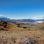
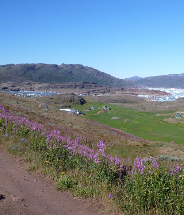
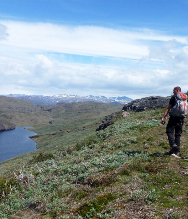
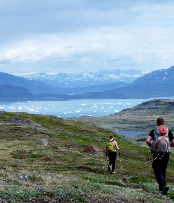
There are numerous hiking opportunities around Qassiarsuk and the area is well suited for less experienced hikers as there are many gravel roads and trails. But even experienced hikers will enjoy spending a few days in the area because the landscape is just so beautiful! It is also a fine place to bring your tent, as there are fantastic places to camp, especially along the Sermilik fjord.
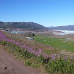
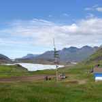
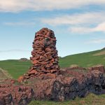
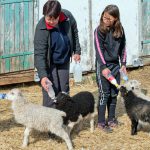
The Qassiarsuk area is well known for its Norse ruins. Qassiarsuk (Brattahlid) was one of the main population centres in the Eastern Settlement (the Norse settlement in South Greenland). The ruins in Qassiarsuk are well marked and you can visit replicas of a longhouse and a small turf church. However, if you keep your eyes peeled, you will notice traces of Norse habitation throughout the entire area. In many cases, today’s sheep farmers chose exactly the same places to settle down as the Norsemen did 1,000 years ago!
The following descriptions can be combined in several ways. The colours of the routes refer exclusively to the overview map and have nothing to do with any trail marks on site, nor do they indicate any particular level of difficulty.
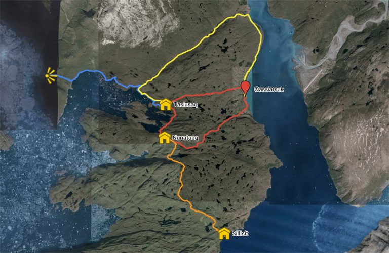
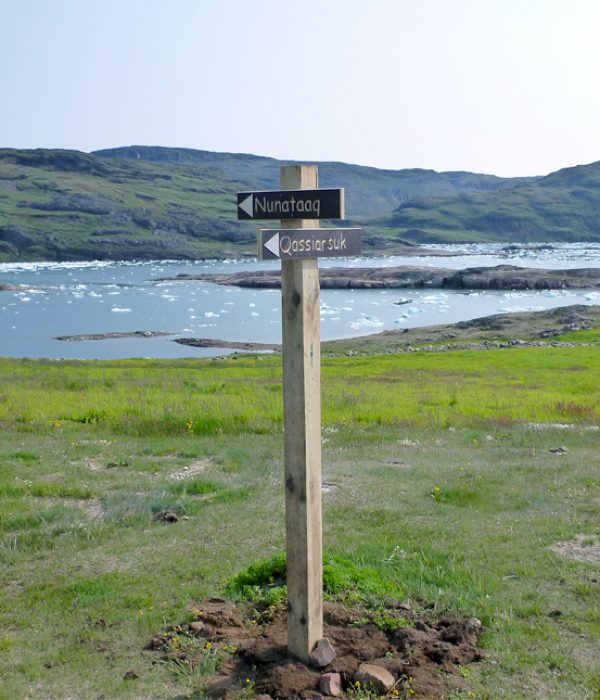
Qassiarsuk – Tasiusaq – Nunataaq – Qassiarsuk. Red route
Distance: About 20 km. 6-7 hours. Max elevation 266 m.
Map: Arctic Sun. Narsarsuaq (Qassiarsuk – Igaliku) 1:50,000
Orientation/difficulty: Marked. Easy hiking. Gravel road and paths.
Accommodation: The hike is a day trip. You can sleep in Qassiarsuk, Tasiusaq and Nunataaq.
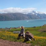
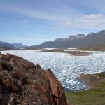
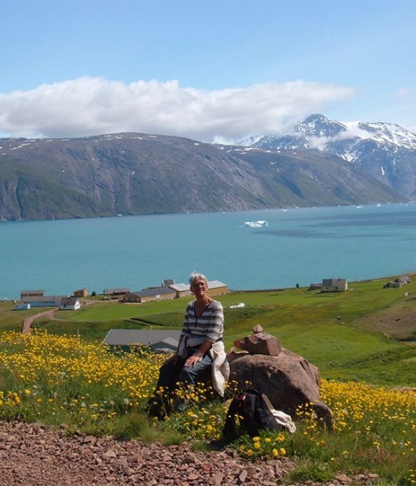
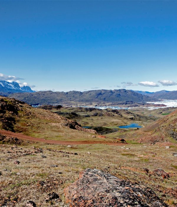
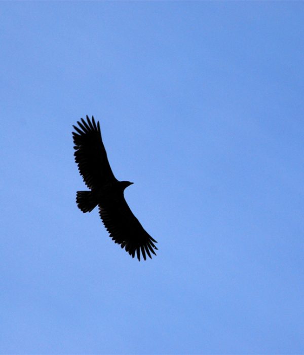
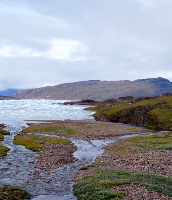
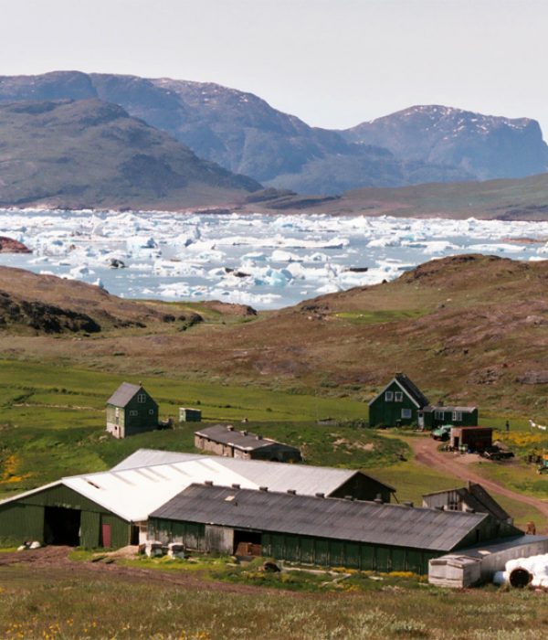
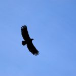
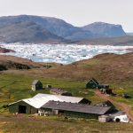
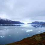
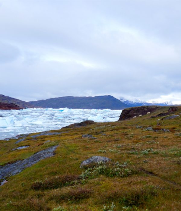
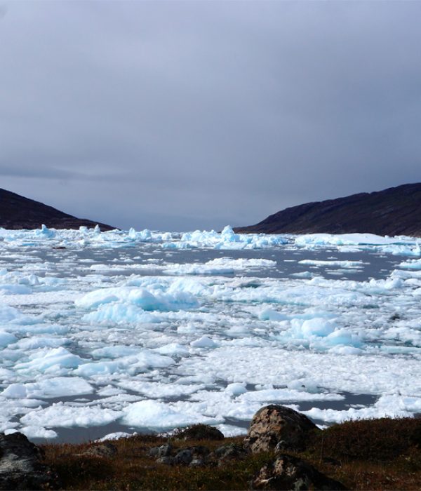
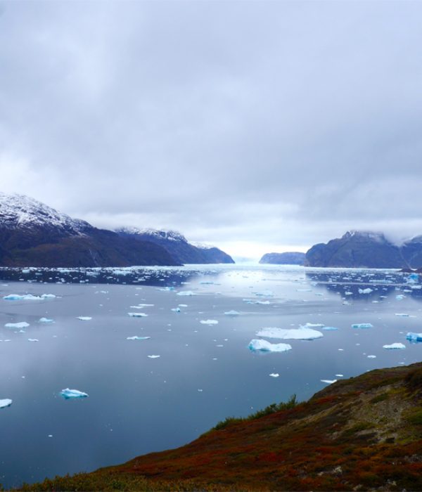
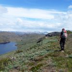
On this tour you will experience a lush, green landscape dotted with small lakes and the ice-filled Sermilik Fjord. You pass by two idyllically located sheep farms and, with a bit of luck, you may see some white-tailed eagles flying overhead. Aside from the ruins in Qassiarsuk, you can see vestiges of Norse farms at Tasiusaq and Nunataaq.
Route description
Follow the gravel road that passes by the church in Qassiarsuk. The road continues west out of the village and begins to climb. There is a fine view over both Sermilik and Tunulliarfik Fjord from the top of the pass (approx. 4 km). Then you gradually descend all the way to the Tasiusaq sheep farm (4 km), which marks the end of the road. Here you take a marked trail along the fjord to the Nunataaq sheep farm (about 3 km). From Nunataaq follow the gravel road back to Qassiarsuk (approx. 9 km). The road is a slightly longer and steeper route than between Qassiarsuk and Tasiusaq. A few kilometres before Qassiarsuk a road branches off to the right and leads to the Inneruulalik, Issormiut and Sillisit sheep farms. However, you continue straight ahead and descend to Qassiarsuk.
Qassiarsuk – Qorlortup Itinnera – Tasiusaq. Yellow route
Distance: About 18 km. Approx 6 hours.
Map: Arctic Sun. Narsarsuaq (Qassiarsuk – Igaliku) 1:50,000
Orientation/difficulty: The route is not marked. Easy hiking. Gravel road and paths.
Accommodation: You can sleep in Qassiarsuk and Tasiusaq. There are also several nice camp sites.
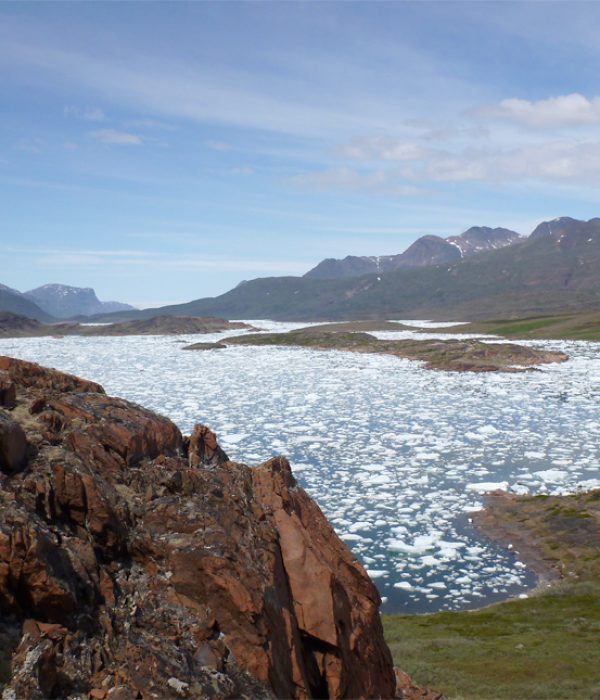
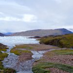
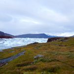
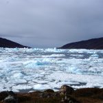
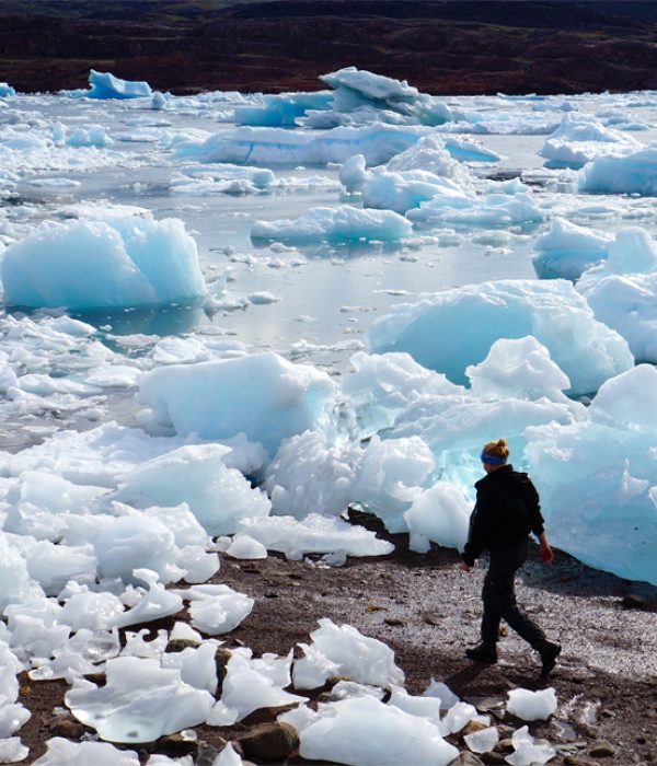
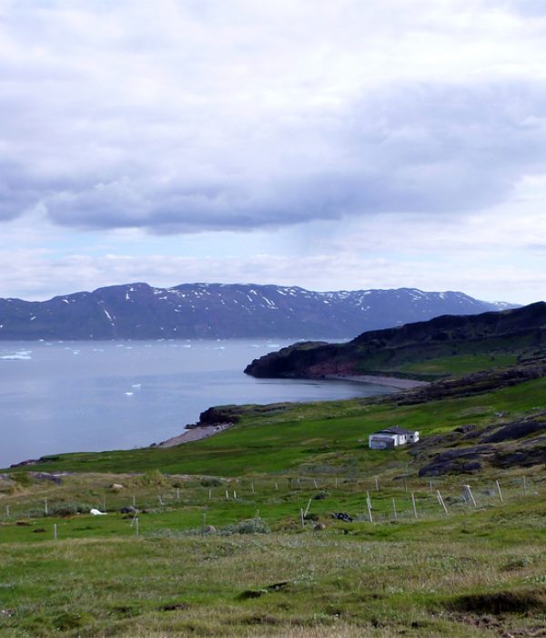
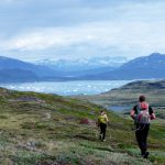
This is a nice walk that passes through the green valley of Qorlortup Itinnera. The valley contains numerous remnants that serve as mute testimony to centuries of Norse settlement. The tour ends at Sermilik Fjord, which is often filled with ice floes.
Route description
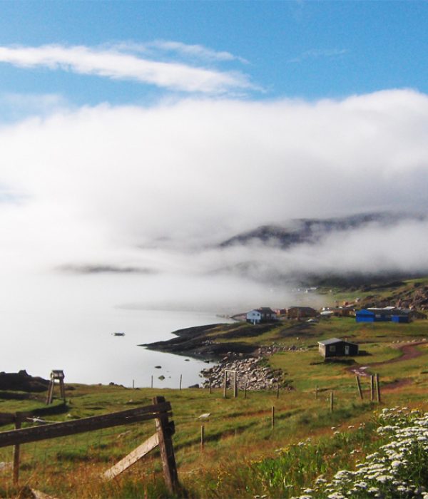
Follow the gravel road along the fjord north of Qassiarsuk. After 5-6 km along the coastal road, a gravel road branches off to the left towards Qoorlortup Itinnera (meaning “Waterfall Valley”). You follow this road to the farm of the same name, located about 2 km farther up the valley. The road ends at the farm, but you continue on sheep trails through the valley to the west. We recommend that you stick to the southern side of the stream, which gradually gets bigger. Where it runs into Sermilik Fjord, there are several perfect places to camp – and you will find a little bridge, which is very helpful if you decide to pitch your tent on the other side of the river. If you have not brought a tent, you may decide to continue to Tasiusaq Hostel (approx. 2 km). It is easy walking on short grass south along the fjord. Here you can stay at the cosy Sermilik Hostel, owned by the sheep farmer (ask for Aviaja).
Tasiusaq – Ipiutaat (return). Blue route
Distance: About 22 km. 6-6½ hours. Max elevation 103 m.
Map: Hiking Map South Greenland. Narsaq (or Narsarsuaq). 1:100,000
Orientation/difficulty: The route is not marked. Easy hiking. Paths and gentle hills.
Accommodation: You can sleep in Tasiusaq or in a tent along the fjord.
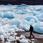
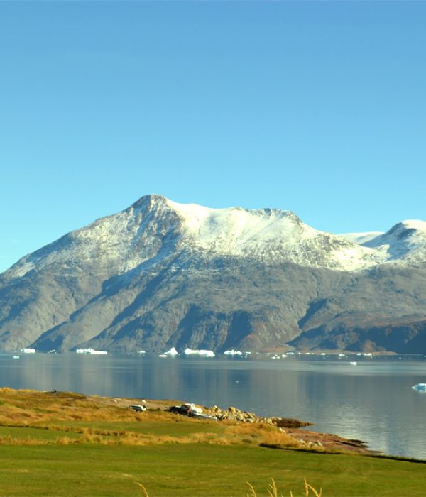
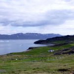
The view from Ipiuttat is fabulous, and even though you take the same trail both ways, the hike along the inner part of the fjord is extremely beautiful and breathtaking. At low tide you can touch stranded icebergs on the beach!
Route description
Follow the gravel road between the farm houses and sheep stables. When the road ends, just continue on the sheep tracks along the coast. After about 2 km you reach the valley of Qorlortup Itinnera and cross the river via a small bridge. You continue along the shore and cross small streams along the way. Normally this can be done dry-shod! After about 6 km you arrive at Ipiuttat Peninsula. You do not need to climb to the top of the peninsula to get a fantastic view. Just walk up to the low pass until you have a view to the north-east, where glaciers are coming down the other side of Sermilik Fjord. The hike back follows the same route. If you hike to the top of Ipiuttat, figure another 4 km and 1 extra hour of walking.
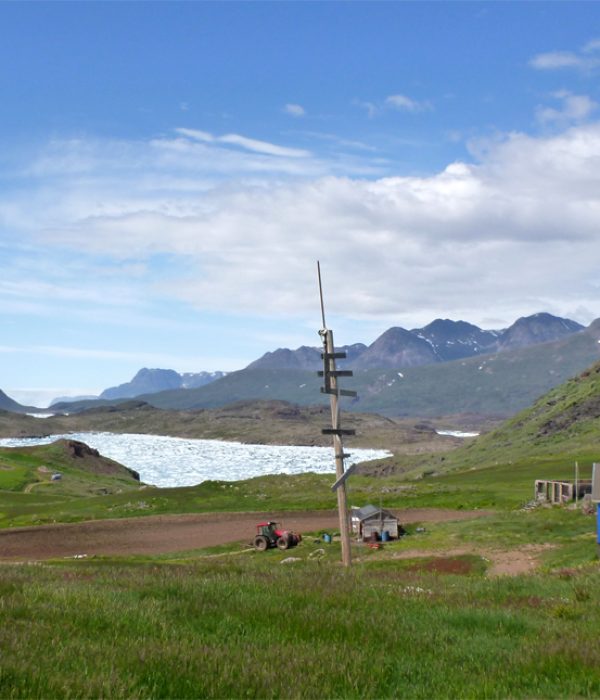
Nunataaq – Sillisit. Orange route
Distance: About 12 km. 4-5 hours. Max elevation 340 m.
Map: Arctic Sun. Narsarsuaq (Qassiarsuk – Igaliku) 1:50,000
Orientation/difficulty: The route is not marked. Moderate hiking. Paths and rolling hills.
Accommodation: You can sleep in Nunataaq and Sillisit.
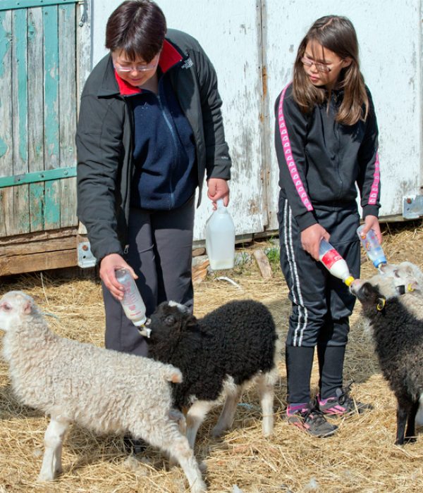
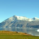
The hike over the rolling hills between Nunataaq and Sillisit is a nice change of pace from the gravel roads. The terrain is undulating with many small lakes, and you will encounter herds of grazing sheep and perhaps see wild ponies. It is inspiring to stay overnight at Sillisit, as the farm is located just opposite the Qooroq Ice Fjord. From Sillisit you can continue on towards Narsaq (a 3-day hike), turn back to Qassiarsuk along the fjord (15 km of gravel road), or catch a boat to your next destination.
Route description
From Nunataaq follow the gravel road towards Qassiarsuk. Once you get through the last fence (after about 800 m), turn right off the road along the fence and continue down to the end of a small pond, and from there proceed uphill along a stream. You reach the end of Lake 110 (on the map) and continue steadily upward in a south-south-easterly direction along the ridge (about 1½ km). There are many sheep tracks, so you should try to choose the one that best matches your intended direction! The terrain is a mix of rocks, grass and low shrubs. Head for the highest point (about 1½ km in a southerly direction), and from there the route goes gently downhill the rest of the way towards Sillisit. At some point you will come across the gravel road that crosses the peninsula between the Sillisit and Kangerlua sheep farms. Follow the road to the east (left) until you reach Sillisit. About 1 km before Sillisit you may have to wade across a small stream.
You can sleep at the Sillisit sheep farm or head back to Qassiarsuk. It is 15 km on a winding gravel road; the first 6 km along the fjord, the last 9 km climbs to about 200 metres in altitude before descending to Qassiarsuk. Sillisit is also the starting point for the hike to Narsaq, read more at: Qassiarsuk – Narsaq.